
We’ve spoken before about the critical need for accurate belt & braces grid references, with a 6-figure map grid reference (GR) placing you inside an area larger than a Wembley football pitch, whereas an 8-figure GR puts you inside the area of my kitchen!
It Mountain Rescue are searching for you, or you have a rendezvous to start a hike, meet other people in a carpark or on the hill, the more accurate your GR the faster you will be found.
Up until 10 years ago in mountain rescue (MR) we only used 6-figure GRs, for the simple reason that we only had compass romers to determine them, and, candidly, these are rubbish. I remember well one night exercise where we had agreed to all end up at a location on the side of a hill that had lots of dips and mounds which obscured your view and we had to search for each other; now there’s an irony!
Military romers were a little better, employing a cut out, combined with better quality printing on thinner plastic, and were reasonable for 6-figure GRs, yet still poor at 8-figure GRs
The first grid reference tool I created had paper lines drawn on to tracing paper and whilst I defo was able to give much more accurate GRs to my fellow MR responders they were of little use as they had romers and my tracing paper idea was only so good until it either rained or got crumpled in my anorak pocket! Yet from this piece of paper the Shavenraspberry Grid Reference Tool (GRT) was born.
Now here’s a twist, you can use our grid reference tool as a fast and accurate romer, that is way more accurate than any compass romer, to double check a grid reference you’ve taken.
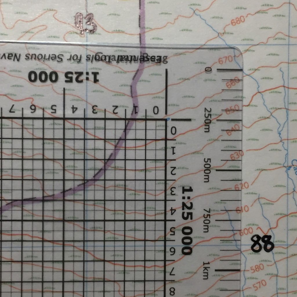
First, simply use your GRT as it was designed, make a note of the GR, and then rotate the GRT through 180 degrees (see bottom pic example using the tiny lochan as a destination!). For 1:25 000 maps place what was the bottom left corner (now top right), the zero zero axis, over the point you’re locating and now read the top horizonal line, where the blue vertical map grid line intersects it, for the easting and then the right vertical line, where the blue horizontal map grid line intersects it, for the northing, your GRs should be very close (the GRT reading will be slightly more accurate).
This method is terrific for people new to taking GRs, and when a GR is critical, it’s the failsafe technique.
A guide on how to use the Shaven Raspberry Grid Reference Tool can be found here – https://shavenraspberry.com/faqs/#collapse-1-10760