

An indespensible piece of kit for anyone who uses Harvey’s brilliant Summit Maps.

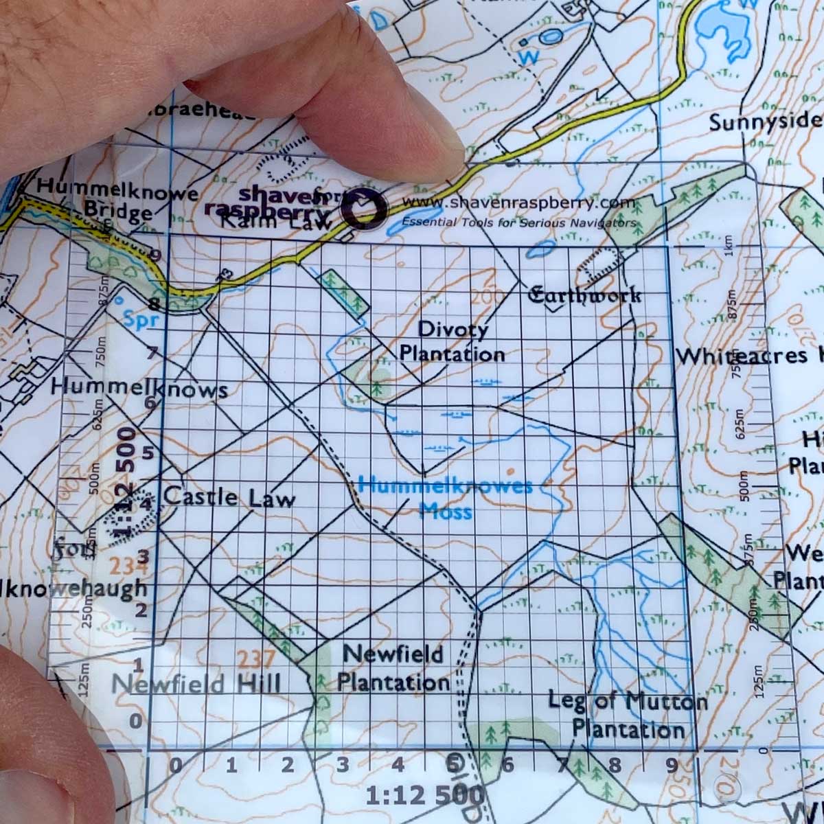

1:12 500 Grid Reference Tool
£2.99
In stock
In stock
Description
1:12 500 Grid Reference Tool for Harvey Maps
An indespensible piece of kit for anyone who uses 1:12 500 maps, such as Harvey’s brilliant Summit Maps, including Scafell and other notorious peaks, plus some of their Superwalker Maps, such as the Malvern Hills or those that cover the Yorkshire Dales.
The first time I used a 1:12 500 was crossing the Black Cuillin Ridge. The difference in detail from the OS Explorer (1:25 000) for me was the same as a black & white TV to a colour – yes, I’m that old! Personally, I’d not cross this ridge using another map and the reason why Skye MRT use them.
I also use this scale of map to train advanced navigation to Special Forces aspirants. With this incredible level of detail my students learn to micronavigate using terrain association alone. The shape of the land is about the only thing that won’t change in a time of war. For this reason, navigating by contour lines is a critical skill and once you get your eye in, this becomes a fluid, efficient way to navigate; practiced repeatedly it will become second nature. This is why orienteers are invariably the best navigators.
A great source off bespoke maps are available from Aqua3 Maps®
Additional information
| Weight | 3 g |
|---|





Reviews
There are no reviews yet.