

Navigators Slope Angle Tool for 1:40 000 15m interval maps


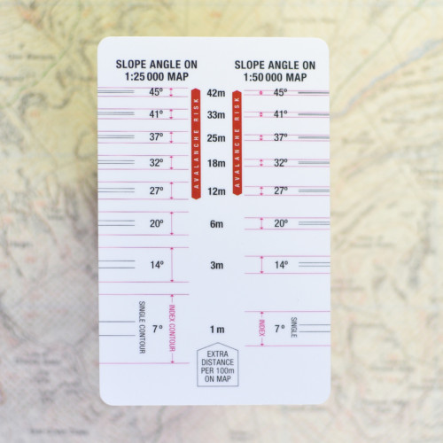
Navigators Slope Angle Tool for Harvey Maps 1:40 000 & 1:25 000
£1.99
In stock
In stock
Description
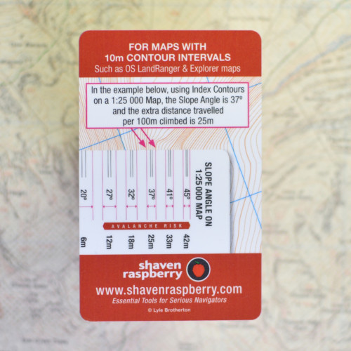
A must for all navigators – Navigators Slope Angle Tool for 1:40 000 & and 1:25 000 scale maps with 15m contours
From your map and on any slope (hill) you can:
- Determine where you are on a slope
- Predict which slopes are prone to avalanche
- Calculate the extra distance you will travel on any slope
- Get your height above sea level
- Know how difficult any slope is to travel over
- Simple ‘How to Use’ guide on reverse
- Works on all 1:40 000 and 1:25 000 scale maps with 15m contours
- Easy to use, no calculations required
It is credit card size in tough plastic, able to fit in purses and wallets,
with rounded corners to prevent snagging and holes in pockets!
This card is designed to be used for the standard contour interval of
15m, such as used on Harvey maps – so it is important to check your
contour intervals before using.
Additional information
| Weight | 2 g |
|---|---|
| Dimensions | 86.00 × 54.00 × 1.00 mm |


Jools –
Cannot fault the slope card. Uncluttered and simple design.
Hannah Collingridge –
Really handy tool. Easy to carry size. Great idea.
Drew –
Great wee tool, just the job. Together with the other SR products a great set of Nav tools.
Tim Oliver –
Well made, robust and clear to use with Harveys. Drilled a hole to add to my nav tools “library”attached to cord in my jacket pocket